17 Historic L.A. Roads You Need To Explore
Published on Thu, Jun 18, 2020
By: Roy Nakano
Fill up the tank, bring some snacks and set up a joyride playlist. There's a gold mine of historic roads in LA, so get ready for a trip down memory lane; it's time for a cruise!
Los Angeles and its surrounding Southern California perimeter are widely regarded as car culture ground zero. That culture includes import tuners, lowriders, custom cars, muscle cars, exotic cars and hot rodders. But there’s a lot more to it than the culture. Unlike its mega-city counterparts in Chicago and New York City, Los Angeles is largely designed from the ground up with cars in mind.
List and article by Susie Ling and Roy Nakano.
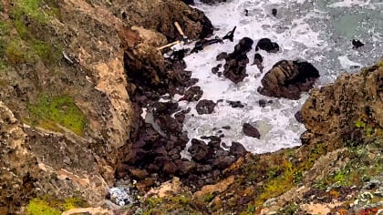
Angeles Crest Highway
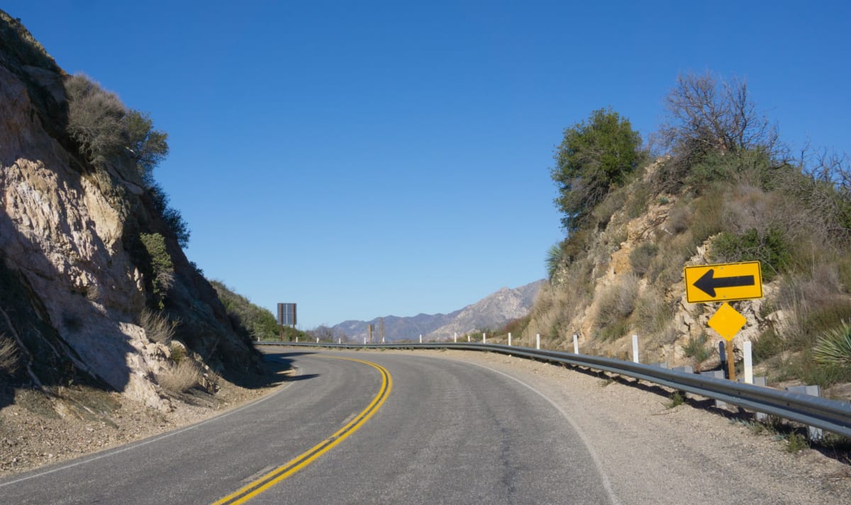
It’s indelibly etched in my mind as the highway my journalist colleague (not with LA Car) missed a turn and took a new Corvette airborne into the Angeles Crest wilderness. It was for KPFK’s The Car Show and its Los Angeles Car of the Year. The Corvette didn’t win, by the way (the new-at-the-time Subaru WRX did).
In addition to its legendary status as a great winding road for car enthusiasts, Angeles Crest Highway is also known as a popular place to stash a dead body. Another colleague—an automotive photojournalist—famously hid the body of model Linda Sobek off this highway. After confessing to his crime, the journalist ended up serving a life sentence. – RN
Arroyo Seco Parkway/Pasadena Freeway

Some people in the know will tell you this is the first freeway built in the country. Others say it’s the third “super highway”, but the first in the state. In either case, you’ll feel its age the moment you drive onto this section of California Route 110. But it’s also the freeway with the most character, with its long tunnels, sweeping landscape, jack rabbit onramps, and unexpected curves. Legend has it those curves are there because the experts at the time wanted the drivers to pay attention to the road as they sped through the parkway with no stop lights to slow them down. You definitely better be paying attention.
And then there are those crazy onramps. If you have a muscle car, the unusually short onramps will be one of the few times you can legitimately put the pedal to the metal in order to merge onto the freeway. To do otherwise might force the ongoing traffic to slow down for you. Conversely, you’ll want to stay out of the right lane once you’re on the freeway to avoid incoming drivers not accustomed to the short onramps. - RN
Central Avenue
In Los Angeles, First Street is the dividing line between the street designated as north and south in Downtown Los Angeles. And so North Broadway is in Chinatown and South Broadway is the theater district. South Main, South San Pedro, South Los Angeles streets all have their own aura. Really, there is no need to say “South” Central as there is no North Central; Central Avenue ends at the Japanese American National Museum. The Avenue extends south to Del Amo Boulevard (named for Dr. Gregorio Del Amo) in Carson. But the moniker “South Central” has taken on mythological proportions.
By the turn of the 20th century, Central Avenue became the African American center of Los Angeles. As early as 1879, John Neimore – who migrated from Texas – established the California Owl newspaper, later renamed to the California Eagle. That was situated near the Sidney Dones Company, which offered real estate, insurance, and legal services in the Booker T. Washington Building at Tenth Street in 1916. In 1924, the African American Fire Station No. 30 was at 1401 Central Avenue. By the 1920s, 41st and Central became the center of West Coast Jazz, with the Dunbar Hotel, built in 1928 as Hotel Somerville.
Between 1914 and 1956, Central Avenue at Fifth Street was the main terminus for the Southern Pacific Railroad. SPRR transported many in the Great Migration of African Americans out of the South. In 1926, Los Angeles voted to merge the three rail lines – Southern Pacific, Union Pacific and Santa Fe – to one “Union Station,” which was completed in 1939 at 800 N. Alameda, the old Chinatown. That’s another story. – SL
Cesar Chavez Avenue f.k.a. Brooklyn Avenue
On Cesar Chavez’ birthday in 1994, Brooklyn Avenue was renamed Cesar Chavez Avenue. In 1876, attorney A. H. Judson purchased 105 acres of hills east of the Los Angeles River. As he wanted to attract New Yorkers to come to Los Angeles, he named this hilly area Brooklyn Heights with its own Prospect Park. The name Brooklyn Heights got lost as its identity merged with its southern neighbor, Boyle Heights.
Boyle Heights was named for Andrew Boyle, an Irishman who found himself in New York, New Orleans, and Texas before settling in Los Angeles in 1858. Brooklyn Avenue, named in the late 1800s, was a multiethnic enclave of Mexicans, Armenians, Russians, Russian-Armenians, Jews, Russian-Jews, gypsies, Japanese, and African Americans. When the Los Angeles Cable Railway opened in 1889, a banner in Boyle Heights read, “East Side Greeting, We Welcome All.” You can find out more about this historic road here. - SL
Colorado Boulevard
In 1964, Dodge launched an advertising campaign featuring an elderly Kathryn Minner speeding down the street, stopping only to face the camera and say, “Put a Dodge in your garage, honey!” That inspired the Jan and Dean song, “The Little Old Lady (from Pasadena)”, depicting an elderly woman who drove a Super Stock Dodge and was “the terror of Colorado Boulevard.” The song forever put Colorado Boulevard on the pop culture map.
Today, Dodge is still running commercials of fast cars on the streets—or as our Editor-at-Large Doug Stokes puts it, “still glorifies street racing.” In reality, Colorado Boulevard is more for cruising than street racing, particularly in the stretch that runs through Old Town Pasadena. In fact, it remains one of the best streets for cruising in that part of town. - RN
El Camino Real/Highway 101

The Spanish friar, Junipero Serra, set out in 1769 to establish a chain of missions in Alta California. The Franciscan monk wanted to set the Spanish stamp from San Diego to Sonoma. The missions would be “a day’s ride” (by horse) from each other, and linked by The King’s Highway or El Camino Real. In truth, the path of El Camino Real has been obscured by history. It probably traveled near Mission Road from the San Gabriel Mission to the LA Plaza.
After 1884 Helen Hunt Jackson’s novel Ramona, a group of boosters including the Automobile Club of Southern California thought to encourage automobile tourism with the “reinvention” of the Royal Road. In 1892, Anna Pitcher of Pasadena lobbied to put distinctive shepherd’s crook – an alleged “Franciscan walking stick” – along the path of the earlier Spanish settlers. The first of the 450 bells was erected at the Plaza Church near Olvera Street in 1906. El Camino Real then moves to Hollywood through Cahuenga Pass to Sherman Way. – SL
The Fruit Tree Streets of Monrovia
Monrovia was founded in 1887, the fourth city to incorporate in Los Angeles County. William Monroe and his partners had purchased most of the land from neighbor Lucky Baldwin. The town center was Myrtle and Orange Avenues. Myrtle was the name of Monroe’s daughter. But like other 19th century California places, Monrovia’s streets are named to lure travelers and settlers out to the west on the new transcontinental rail lines.
Not unlike a few other towns, Monrovia has streets named Orange, Lemon, Lime, Palm, Chestnut, Maple, Almond, and even Banana. But Orange Avenue was later renamed Colorado Boulevard. While the Colorado Boulevard in Monrovia bears no resemblance to the bustling one in Pasadena, the renaming allowed the boulevard to stretch eastward to the city limits. - SL
La La Land Landing a.k.a. the 105-to-110 HOV onramp to the sky
This is the ramp shown in the opening scene from the movie “La La Land”. The sky-high freeway connector was a perfect backdrop for choreographer Mandy Moore’s spectacular, six-minute performance by an ensemble of leaping dancers, skateboarders, stunt bikers, and parkour tracers, lined bumper-to-bumper in their cars on the ramp. Of course, you won’t be able to dance on this ramp, but you can soar through the air like they did, so long as you have Express Lane access. - RN
Laurel Canyon Boulevard
There’s an excellent documentary by Alison Ellwood that was recently released showcasing practically everything you want to know about Laurel Canyon (“Laurel Canyon: A Place in Time”). Laurel Canyon Boulevard is the major throughway for this secluded, woodsy part of the hills above Hollywood. Some of the best music of the late 1960s and early 1970s came out of this part of town (think Joni Mitchell, Crosby, Stills, Nash and Young, the Mamas and the Papas, Love, Doors, Jackson Browne, the Eagles, and a host of others).
Stephen Stills wrote Buffalo Springfield’s “For What It’s Worth” after driving down from Laurel Canyon and encountering the Sunset Strip curfew protests down below the Hollywood Hills in 1966. Laurel Canyon was also the location of the infamous Tate-LaBianca murders. It remains a special place in time. - RN
Los Angeles Street
In 1781, El Pueblo de Los Angeles was founded on the west bank of the Los Angeles River by 44 pobladores of mixed racial heritage. The little town grew and its first north-south streets included Calle Principal (now Main Street), Calle Primavera (Spring Street), Calle Loma (Hill Street), Calle de los Indios (now Wilshire Boulevard), and Calle de los Negros, renamed to Los Angeles Street in 1877.
An early 1840s document suggests that the then unnamed street was “owned by some of the most substantial citizens of Los Angeles” who were “men of very dark complexion”, and thus it became “Negro Alley”. In the 1850s, the 4000 populating Los Angeles were a rowdy group with about a murder a day mostly around Calle de los Negros. The more we change, the more we are the same. You can find out more about Los Angeles Street here. – SL
Mulholland Drive
It’s the name of a critically acclaimed David Lynch psychological thriller. Mulholland Drive is also a favorite venue for car companies to show off the handling capabilities of their latest machinery to members of the media. And no wonder: The Drive offers spectacular views of the San Fernando Valley, the Los Angeles Basin, and even the iconic Hollywood sign.
It spans 21 miles, connecting the Santa Monica Mountains with the Hollywood Hills. Just be careful about your speed when maneuvering those turns—particularly the most dangerous turns on Mulholland Drive, appropriately nicknamed “The Snake”. The local law enforcement is also well aware of the popularity of Mulholland Drive amongst the city’s speedster set. Go too fast, and you either risk a ticket or risk running off the road. - RN
Olympic Boulevard
A major arterial road from Santa Monica to East LA, Olympic Boulevard was Tenth Street – sandwiched between Ninth and Eleventh. In 1932, Tenth Street was renamed in honor of the 1932 Summer Olympics held in Los Angeles. – SL
Route 66

Nicknamed the Mother Road, Route 66 spans 2,448 miles. As Bobby Troup wrote and Nat King Cole sang, “it winds from Chicago, goes to St. Louis, down to Missouri. Oklahoma City looks oh so pretty. You'll see Amarillo, Gallup, New Mexico, Flagstaff, Arizona. Don't forget Wynonna, Kingman, Barstow, San Bernardino.” And, of course, it all ends at the Santa Monica Pier.
They named a TV show after it. The Disney animation film “Cars” is all about the old Route 66. And while Interstate Highway 40 has replaced much of Route 66 in the western states, the old route is still there and well worth the time to explore. If you’re a fan of Disney’s “Cars”, you’ll recognize a lot of familiar landmarks. – RN
Sunset Boulevard

It starts in Downtown Los Angeles and stretches 22 miles westward, all the way to the ocean and Pacific Coast Highway. In between, you’ll pass through Echo Park, Los Feliz and Beverly Hills. As you move further west into Bel-Air, the scenery gets more lush and the road curvier—and it stays lush and curvy all the way to Pacific Palisades. There’s a movie named after it (by Billy Wilder), a musical (by Andrew Lloyd Weber) and a TV show (77 Sunset Strip). It includes the most famous intersection in Hollywood (Sunset and Vine).
In 1964, Jan and Dean sang about it in “Dead Man’s Curve”, which is a song about a driver in a Corvette that crashes at one of the deadliest curves on Sunset Boulevard. Two years later, Jan of Jan and Dean would have a near-fatal accident after crashing his Corvette in an area not too far from Dead Man’s Curve. - RN
Valley Boulevard
Before the advent of freeways, Valley Boulevard was the route one took from Pomona to get to Los Angeles. Even those in San Bernardino County would take Holt Boulevard until it connected to Valley Boulevard in Pomona to get to Downtown Los Angeles. You can still take this route—particularly if the freeways are jammed. The speeds will be a bit more leisurely, but the scenery more interesting than the concrete surroundings of the freeways. And as you travel through San Gabriel Valley, you’ll be passing some of the best Asian restaurants in the Southland. - RN
Whittier Boulevard
“Let’s take a trip down Whittier Boulevard!”, sang Thee Midnighters back in 1965. The song became an anthem for the lowriders that cruised up and down the street in the 1960s, 1970s and still to this day. Whittier Boulevard is also noteworthy as the site of some of the zoot suit riots of the 1940s. It was the epicenter of the National Chicano Moratorium March against the Vietnam War, where Los Angeles Times reporter Ruben Salazar was killed by LA County Sheriff deputies after being hit by a tear gas projectile.
Today, Whittier Boulevard is known for its abundance of Mexican cuisine, with street vendors serving up bacon-wrapped, onion-grilled hot dogs, esquites corn-on-the-cob lathered in butter, cheese, mayonnaise and jalapeños, and the full spectrum of tacos. - RN
The Great Streets Initiative
Did you know the City of Los Angeles has its own list of great streets it wants people to know about? Many of the streets on its list don’t appear on our list. As stated on the City’s site, “Mayor Eric Garcetti started the Great Streets Initiative: to serve, support, and strengthen the vibrant corridors that are the backbone of Los Angeles.”
According to the GSI organizers, they started out focusing on 15 corridors across the city where they are coordinating city resource, building partnerships with communities, and leveraging additional resources to transform the streets. There are now 18 designated Great Streets. You can find out more—and even take part in transforming the streets—by going to the City’s site here.
Did we miss anything? Of course we did. Because a list of noteworthy drives in Los Angeles is in fact an endless list. We therefore welcome your additions to this topic. Let us know what your favorite roads are by going to the LA Car Facebook page, which you can get to here. – Susie Ling and Roy Nakano